
A single-story campus reads as simple from the road: one long building, a parking field, some grass. Flown for a survey, it is anything but. On a recent mission over a First Coast site, one photogrammetry sortie produced two deliverables from the same image set — a georeferenced RGB orthomosaic and a textured 3D mesh — each tied to a coordinate frame that holds up when someone measures off it later.
The point of this post is not the pictures. It’s that a survey deliverable is only worth what its accuracy statement can defend, and most of the work happens before the aircraft leaves the ground.
The site and the sortie
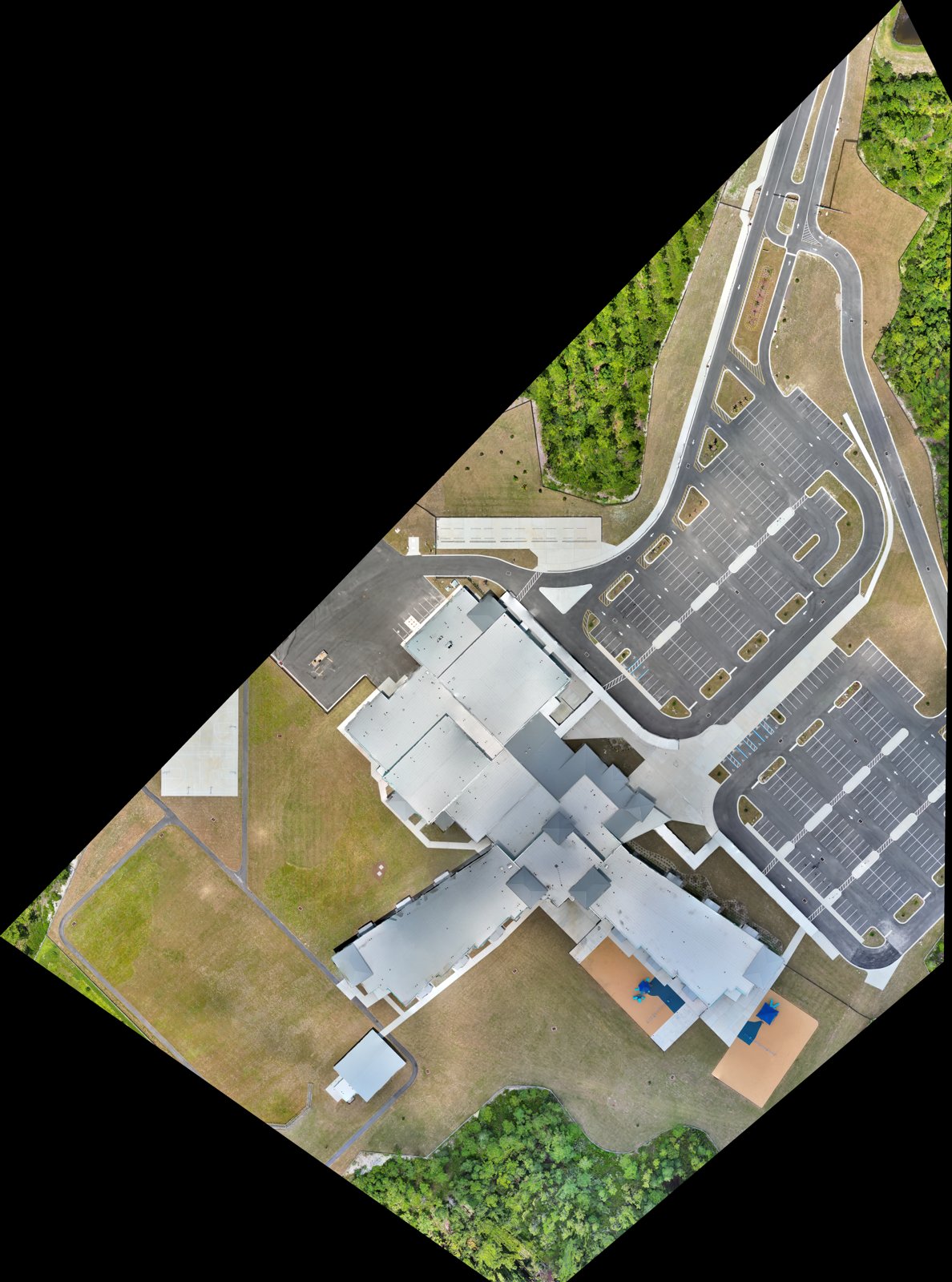
The subject was a single-story institutional campus — one large building footprint, service drives, a striped parking field, and open ground running back to a tree line. Anonymized here at the site level; the methodology and deliverables are what generalize.
It came off as one sortie flown under FAA Part 107. The flight plan was a nadir grid across the whole property with high forward and side overlap, plus an oblique pass around the structure so the walls and roof edges reconstruct instead of smearing into the ground. Overlap is not a knob you turn up for insurance — it’s what lets the processor find the same tie point in enough frames to solve geometry. Skimp on it over a low-texture roof or a flat asphalt lot and the model thins out exactly where you need it.
How it was flown, not just what
Two datasets are only useful if they sit in the same coordinate space, and that comes from control, not from the software’s optimism. The mission carried RTK positioning on the aircraft with corrections referenced to a known station, and independent ground checkpoints were set across the property — points I hold out of the bundle adjustment so they can verify the solution rather than flatter it. Checkpoints you feed into the adjustment prove nothing; they just tell you the math is internally consistent. Held out, they tell you the truth about your error.
That distinction is the whole ballgame for ASPRS 2024 (Edition 2, v2.0) positional accuracy. The standard doesn’t let you call data “accurate.” It makes you state a class — a horizontal and vertical RMSE the product actually meets — and back it with checkpoints. A deliverable that cites its ASPRS class is making a testable claim. One that says “survey-grade” in a proposal is making a marketing claim. Those are not the same document, and an engineer stamping a drawing off your exhibit knows the difference.
What the two deliverables show
The orthomosaic flattens the whole site into one georeferenced image. Unlike a single aerial photo, it has no perspective lean — measure a drive lane on the west end and a roof section on the east and both scale correctly, because every pixel is orthorectified to the same ground plane. That’s what makes it a base layer engineers and planners can trace over, not just a nice overhead shot.
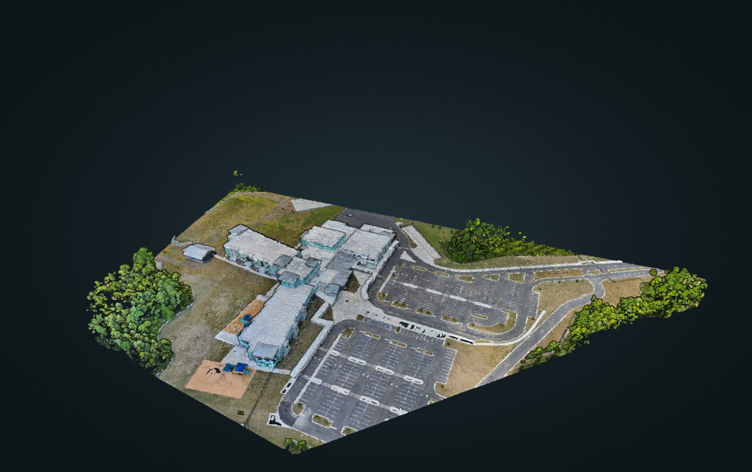
The mesh carries what the ortho can’t: elevation and volume. Roof planes have pitch, the ground has grade, the building has massing you can section and measure. Same photos, same control — a second product that answers questions a flat image can’t, from parapet heights to drainage fall to how a proposed addition sits against the existing envelope.
What a georeferenced set is actually for
I won’t invent a change order the client didn’t make. What I’ll say is what this deliverable set is built to do, because that’s the reason to fly it to a standard in the first place. A georeferenced ortho drops straight under a CAD or GIS drawing as a scaled base map. The mesh supports quantity takeoffs, grading and drainage review, and as-built comparison against design. And because both are tied to a stated accuracy class with a documented capture, they carry weight as a record — for a design team, an owner’s rep, or an insurer — instead of being one more folder of pretty pictures.
That last part matters more than it sounds. The value isn’t that a drone can make a 3D model. Half the operators in the state can generate a mesh. The value is that this one comes with a defensible statement of how accurate it is and how it was produced.
Standards and chain of custody
Every mission is documented so the deliverable can be authenticated later, not just admired. The record ties the imagery to the sortie: flight logs under Part 107, the RTK correction reference and control layout, the held-out checkpoint results behind the stated ASPRS 2024 class, and the processing lineage from raw frames to finished product. When a deliverable may end up as an exhibit, that chain is what lets it satisfy authentication under FRE 901/902 — evidence is only as good as your ability to show what it is and where it came from. We build that chain on every job, whether or not anyone ever asks for it, because you can’t reconstruct it after the fact.
Takeaway
A survey deliverable is a claim about accuracy. Fly it to a named ASPRS class with held-out checkpoints and a documented capture, and it holds up when someone measures off it, files with it, or defends it. Everything else is a picture.