
The Atlantic season peaks around September 10. If you run an active site on the First Coast, the useful window for documenting it closes when the watch goes up — not when the storm clears.
After landfall, everyone documents. Phones come out, adjusters get called, and the folder fills with close-ups of the thing that broke. What almost nobody has is the other half of the comparison: a dated, measurable record of what the site looked like the week before. Damage claims, delay claims, and erosion-control disputes all turn on a before-and-after. Most sites only ever produce the after.
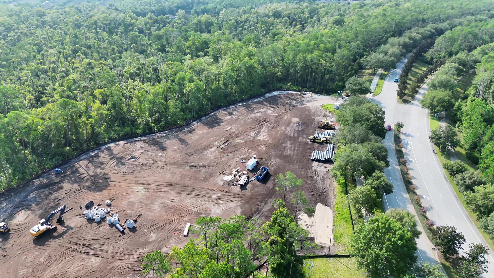
Phone photos are records. They are not baselines.
A phone photo proves something existed. It doesn’t prove where, how much, or how it changed, and that’s usually the whole argument.
Three things separate a baseline from a camera roll:
Position. Every pixel sits at a known coordinate, so a stockpile you photographed in August can be measured against the same ground in October.
Coverage. The camera roll documents what somebody thought to photograph. A grid sortie documents the site — including the corner nobody was thinking about until the water came through it.
Provenance. Capture date, aircraft, sensor, flight log, and processing chain travel with the data instead of living in someone’s memory of when they took the picture.
That’s the difference between an exhibit and a slideshow. Under FRE 901 and 902, a record has to be authenticable — someone must be able to establish it is what it purports to be, captured when it purports to have been captured. Imagery with intact EXIF, a corresponding flight log, and a documented processing chain clears that bar without a fight. Twelve photos texted from a superintendent’s phone six weeks earlier generally do not.
What’s actually worth capturing before a storm
Four layers cover most of what gets argued about later.
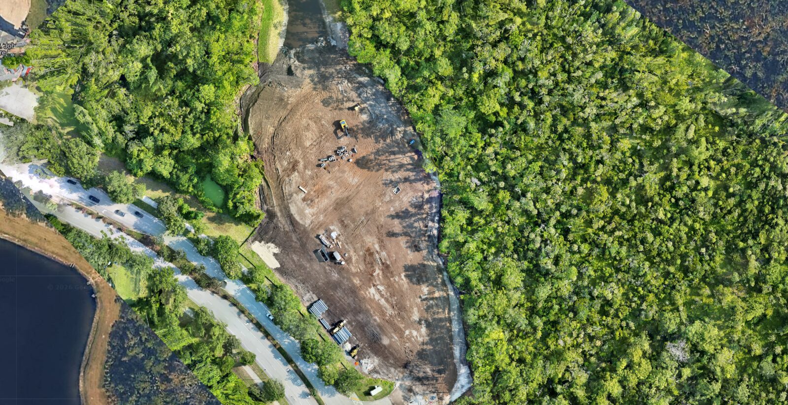
A site-wide RGB orthomosaic. One georeferenced, orthorectified image of the entire property. No perspective lean, so a measurement on the west end scales the same as one on the east. This is the layer you overlay the post-event flight onto.
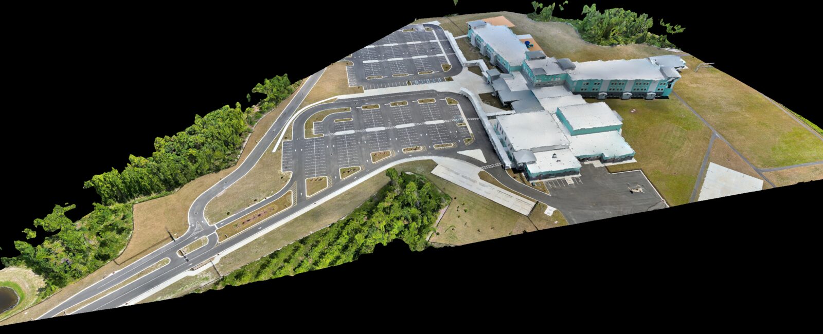
A 3D reconstruction or point cloud. Earthwork disputes are volumetric. A mesh or dense cloud captured pre-event lets you compute cut-and-fill against a post-event surface instead of arguing about how much material moved. It also captures vertical structure — stockpile heights, wall and form conditions, staged equipment — that a top-down layer flattens.
Perimeter and erosion control. Silt fence, inlet protection, stabilized entrances, slope condition, outfalls. Post-event enforcement questions tend to be about whether controls were installed and functioning before the rain, and that is answerable only with a dated capture.
Staged materials and equipment. Where the pipe was, where the trailers were, where the lay-down yard sat. Wind moves things. A pre-event position for each of them turns “we think it was over there” into a coordinate.
Accuracy you can state, not describe
A baseline is only as good as the coordinate frame it’s tied to. Ours are flown with RTK correction referenced to a known station, with ground checkpoints set across the site and held out of the bundle adjustment so they verify the solution instead of flattering it. Checkpoints fed into the adjustment only prove the math is internally consistent with itself.
That’s what allows a stated accuracy class under ASPRS 2024 (Edition 2, v2.0) — a horizontal and vertical RMSE the product actually meets, backed by checkpoints — rather than a proposal that says “survey-grade.” When your pre-event and post-event datasets both cite a class, the change between them is a measurement. When neither does, it’s an opinion with pictures.
All of it flies under Part 107, which matters more than usual in a storm window: after a major event, temporary flight restrictions and recovery operations routinely close the airspace over affected areas for days.
The timing is the hard part
The practical constraint isn’t cost — it’s that everyone calls at the same time, and by then the window is closing. Ceiling and wind degrade a photogrammetry sortie well before conditions look dramatic from the ground, and once the watch is posted, sites are shutting down and crews are securing equipment.
The version of this that works is not storm-triggered at all. Sites already on a monthly or bi-weekly progress-monitoring cadence have a current baseline at all times, because the last flight was never more than a few weeks ago. The storm capture becomes just another cycle rather than a scramble. Sites with no cadence are trying to buy documentation inside a 72-hour window shared with everyone else in the county.
If you don’t have a cadence, the fallback is straightforward: fly a full baseline early in the season, refly it when the site changes materially, and treat the post-event flight as the comparison rather than the record.
Takeaway
The post-event flight is the one everybody remembers to order. The pre-event flight is the one that makes it worth anything. If your site has changed materially since the last time it was documented, September is not the month to let that ride.