
Every site. Every week.
Documented from the air.
Weekly orthomosaic, 3D site model, cut/fill volumetrics — delivered to your project team within 48 hours. Owners see progress on demand. PMs defend change orders with time-stamped evidence.
What lands in your data room every flight.
Not photos on a phone. Not hero shots. A complete geo-referenced record you can hand to an owner, an engineer, or a court.
Weekly 2D Orthomosaic
RTK photogrammetry with FPRN corrections. 3 cm vertical accuracy per ASPRS 2024 Ed. 2 v2.0 Class II. Full-site geo-referenced TIF + web-viewable JPG.
3D Site Model
Textured mesh + point cloud. Import into Bentley, Trimble, or ESRI. Walk the site from your desk. Overlay against as-planned CAD.
Cut / Fill Volumetrics
Per-zone cubic yardage calculations. Verify earthwork claims. Track stockpile inventory. Reconcile against dirt-hauler tickets.
Week-over-Week Overlay
Side-by-side comparison of this-week vs. last-week. Owner reviews at a glance. Slip alerts before they turn into a call.
Chain-of-Custody Log
Every image time-stamped, GPS-tagged, flight-log referenced. Change-order defense pack ready if the dispute goes anywhere serious.
Owner-Ready Snapshot
1-page executive PDF per flight. Screenshot-ready for the weekly owner email. No re-processing on your end.
One flight is a snapshot.
A cadence is intelligence.
Weekly or bi-weekly aerial capture across the life of your build. The data compounds — every flight is more valuable than the last because you can compare against what came before.
Change orders don't wait for the monthly walk. Draws don't wait for the ground photo. Lenders and owners want current evidence, and they want it before they ask.
- Week 01 Baseline flight
Full site captured before ground is broken. Establishes the reference every future flight compares against. Original-condition record for future disputes.
- Ongoing Weekly or bi-weekly flights
Consistent day-of-week, consistent altitude, consistent flight path. Comparability requires discipline. Every deliverable formatted identically for owner + lender consumption.
- Monthly Draw request package
One click, four deliverables: current ortho, 3D model, week-over-week overlay, and a 1-page owner-ready snapshot. Attach directly to the draw request. Lender approves faster.
- On call Change-order or dispute triggers
Sub claims scope moved? Owner disputes progress? Weather event? Priority flight within 48 hours, deliverable ready for the meeting.
- Close-out Final aerial record
As-built ortho + 3D model of the finished site. Handed to owner for record retention, insurance, facilities. Also becomes the baseline for future capital projects on the same site.
Actual output from active projects.
Not stock imagery. Not renderings. These are real deliverables from live construction sites — the same files you'd receive after your first flight.
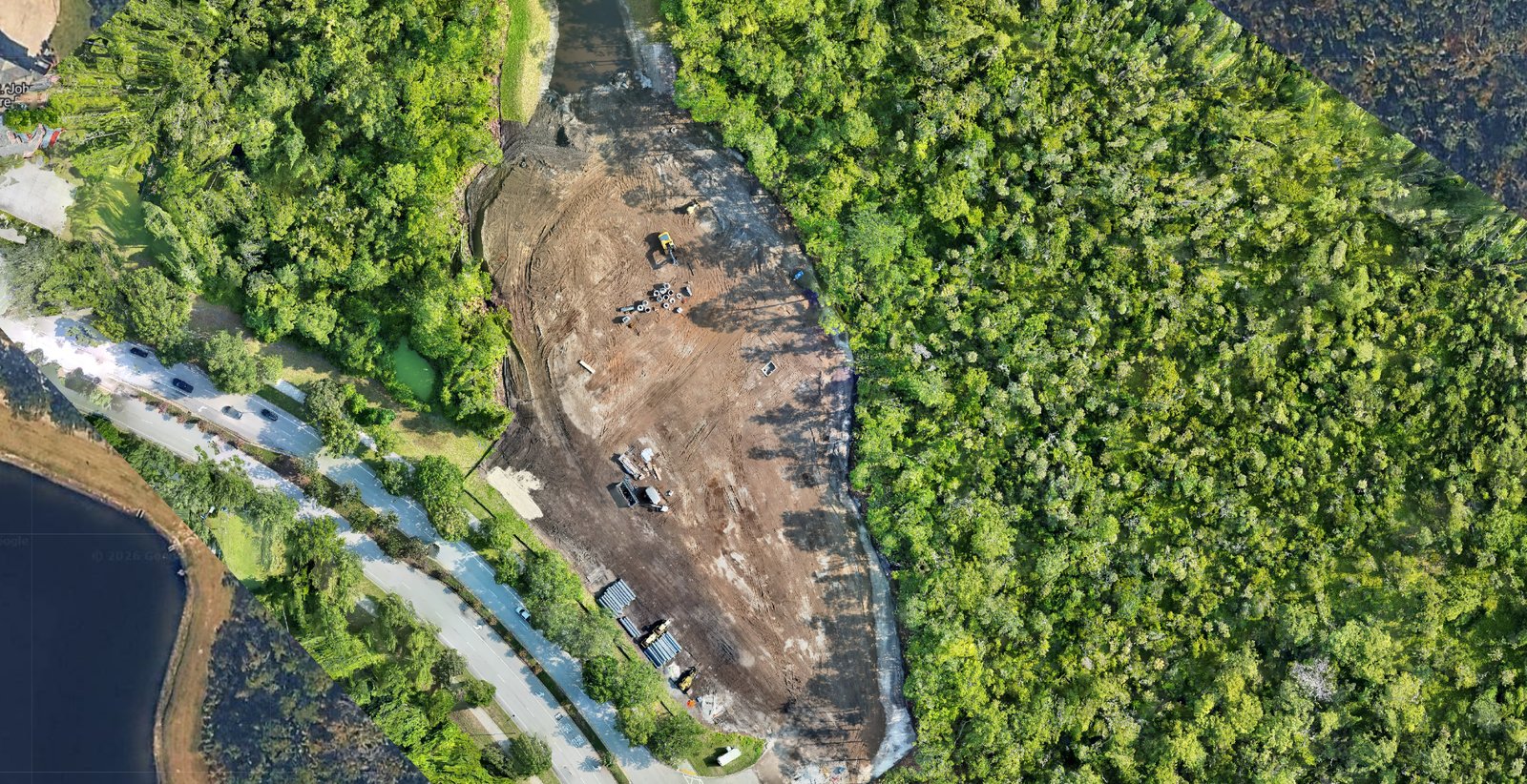
2D Orthomosaic
A geo-referenced top-down photograph of the entire site, stitched from hundreds of overlapping images at 3 cm accuracy. Zoom in on any square meter and see the actual conditions on that flight day.
- ▸ Track equipment positions, material staging, site logistics
- ▸ Compare against site plan for as-built verification
- ▸ Feed straight into Bentley, Trimble, AutoCAD, or ArcGIS
- ▸ Snapshot for owner or lender draw packages
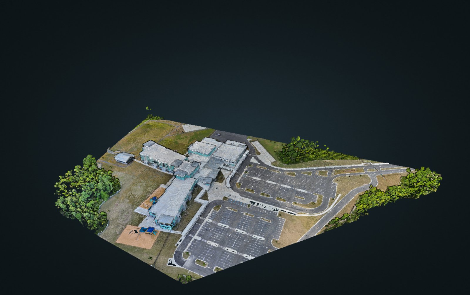
3D Site Model
A textured 3D reconstruction of the entire site — buildings, parking, terrain, vegetation. Walk it in a browser, rotate any angle, measure any distance without ever setting foot on-site.
- ▸ Elevations, distances, and volumes measurable from any angle
- ▸ Overlay against as-planned CAD for constructability check
- ▸ Embed in owner reports as an interactive exhibit
- ▸ Preserve the historical record — every flight, every angle, indefinitely
Progress Monitoring · Stakeholder View
A silent, self-playing orbit of your active site delivered every flight. The 30-second version that lands in an owner's inbox and answers the "how's the site looking?" question before it gets asked.
- ▸ Embed in the weekly owner email — plays in-line, no login required
- ▸ Attach to the draw request package for lender visibility
- ▸ Board decks + investor updates — motion draws attention where a still doesn't
- ▸ Absent PMs, remote owners, silent partners — everyone sees the same site
First flight is complimentary on active commercial projects in Northeast Florida.
What weekly aerial pays for itself against.
Time-stamped, geo-referenced imagery is evidence. When a sub claims scope changed, you have the record. Most GCs recover the annual monitoring cost from one contested change order.
Week-over-week overlay surfaces slippage the moment it starts — before the owner call, before the trade calls, before the schedule call. Course-correct while it's cheap.
Stop walking the site with a phone. Stop chasing subs for status. Owner asks "how's it going?" — send the ortho + snapshot in 30 seconds.
Draw request package includes a professionally-processed aerial. Lenders release faster. Owners fund without question. Insurance claims (if needed) start from a documented baseline.
Aviation-grade process, standards-cited output.
Every flight briefed and logged. Every deliverable cites the standards it was flown to. The record survives audit, adjuster review, and litigation.
- ASPRS 2024 Ed. 2 v2.0 Positional Accuracy Standards
Class II — 3 cm vertical accuracy. Delivered accuracy class stated on every report.
- FPRN RTK Florida Permanent Reference Network corrections
Sub-centimeter positional accuracy. State-provided base stations. No manual GCP survey required for most sites.
- FAA Part 107 Remote Pilot Certificate · ATP Captain
Airline Transport Pilot Captain flying commercial daily. Aviation-grade discipline applied to every mission.
- $1M Commercial liability + UAV hull coverage
SDVOSB in pursuit. Insurance certs on file. All standard GC vendor onboarding requirements met.
Prove the value on your current site before committing to a program.
First flight is complimentary on active commercial projects in Northeast Florida. You see the deliverable, we see the site, then we scope a weekly or bi-weekly cadence that fits the schedule and the budget.