
Some of the most consequential work on a site is also the work that disappears first. Storm pipe goes in and gets backfilled. A retention pond is cut, shaped and stabilized. Six months later nobody can say what the grade was on the day it was accepted.
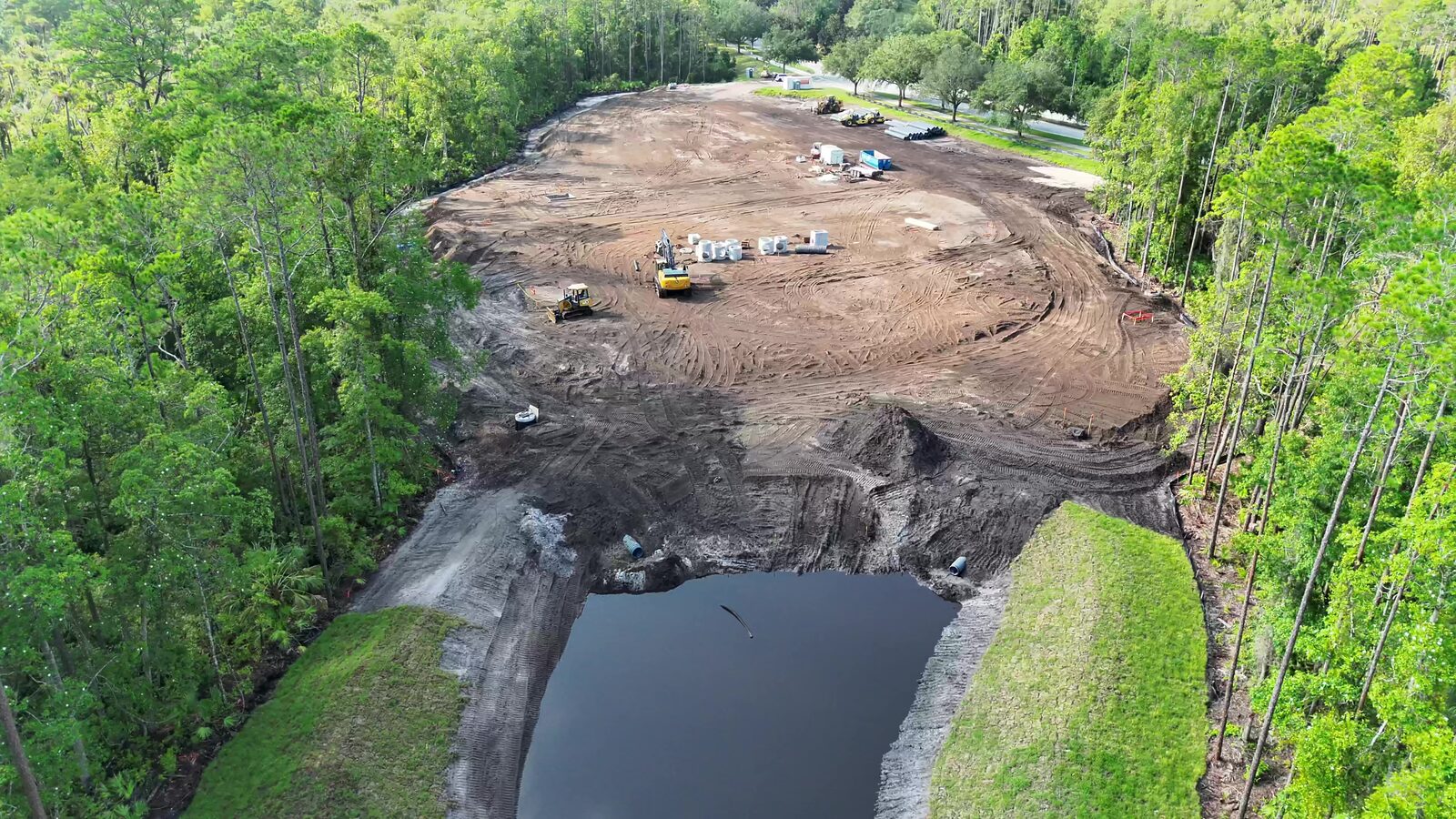
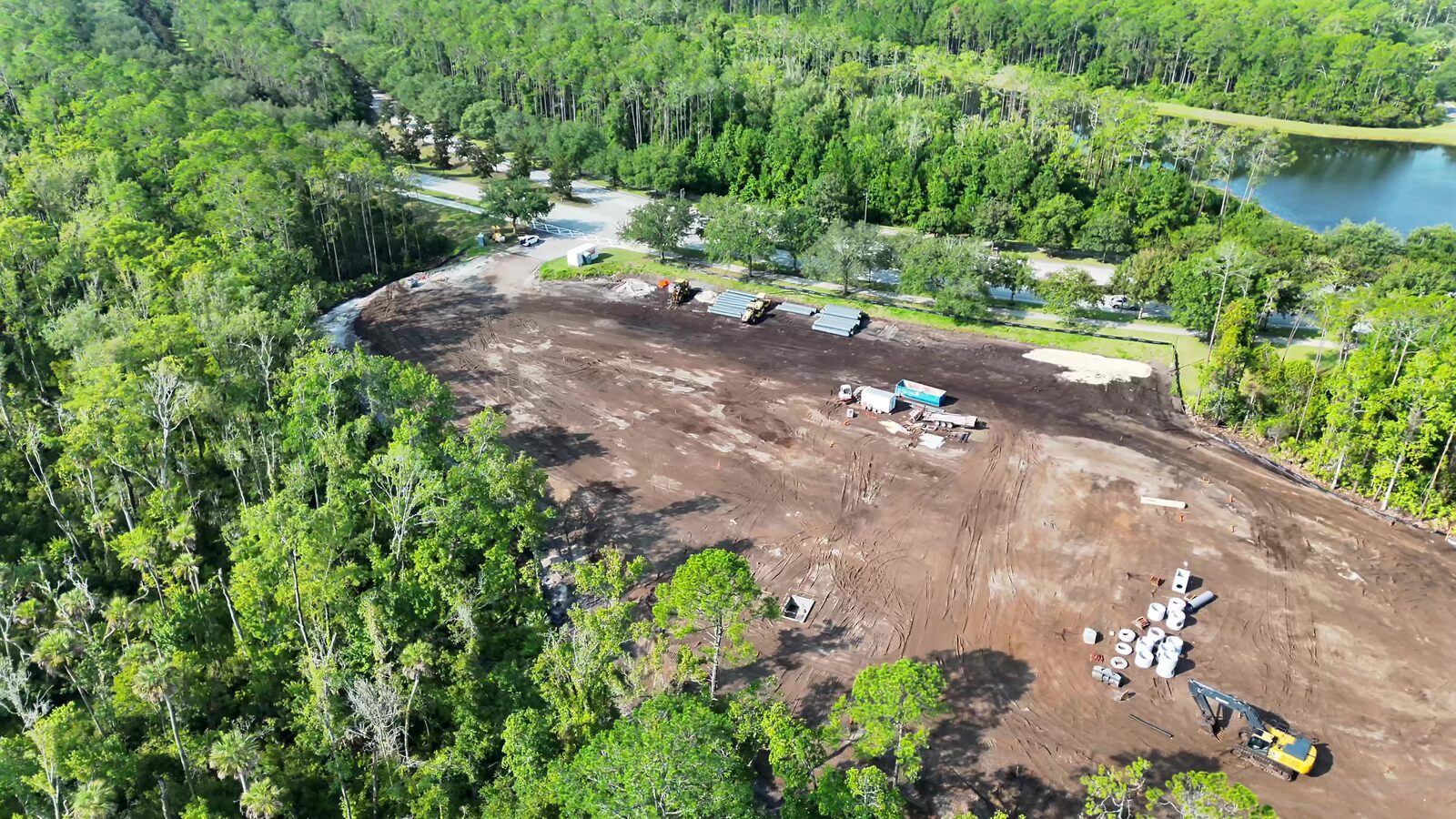
On a recent mission over a mass-graded commercial pad on the First Coast, we flew the site at exactly that stage: pad rough-graded, storm pipe and structures staged, culverts set at an open retention pond. It is a good example of what a dated aerial record is for.
Site and mission
The site is anonymized here at the project level. It is a cleared, mass-graded pad bordered by mature tree line, with a stormwater pond at the low end and a construction entrance on the road frontage. Equipment on site during the flight included an excavator and dozers, with pipe and precast structures laydown on the pad.
The sortie was flown under FAA Part 107 with a nadir grid for the mapping products and an oblique orbit for context. Overlap was set for the low-texture bare soil, which is where photogrammetry thins out first. Tall tree line on three sides means the edges of the model are the weakest part, so we plan the perimeter passes deliberately rather than trusting the grid.
Methodology
The aircraft flew with RTK corrections from a known reference. Independent ground checkpoints were set across the pad and around the pond, and held out of the adjustment so they verify the solution instead of flattering it.
That is what makes an accuracy statement possible under ASPRS 2024 (Edition 2, v2.0). The standard asks you to name a class and support it with checkpoints. For earthwork, the vertical number is the one that matters, because volume and grade are vertical questions. We state the class and the checkpoint results with each delivery. We do not quote a figure before the checkpoints are processed.
What the record captures
From one image set the deliverables are a georeferenced orthomosaic, a surface model, and a textured mesh. Each answers a different question.
The orthomosaic locates things. Where the pipe is staged, where the pond outlet sits, where the haul road runs, and how far the pad is from the tree line. Everything scales correctly because it is orthorectified to one ground plane.
The surface model measures things. Pond side slopes, pad cross-slope and drainage fall can be sectioned and compared to the plan. Stockpile and pad volumes come from the same model, which is why the checkpoint discipline matters.
The mesh preserves things. Culvert inlets and headwalls are visible today and will be under fill soon. A dated 3D record of them is difficult to recreate afterward.
What a project team does with it
I am not going to describe a change order this client did not file. What this record is built to support is a short list of tasks that come up on every earthwork job: comparing pond grade and slopes to the design before stabilization, checking pad grades before base rock goes down, reconciling pay quantities with the contractor, and documenting the as-found condition of pipe and structures before they are covered.
If a dispute arises about what was placed and when, a flight-dated model with a stated accuracy class is a different kind of evidence than a folder of phone photos.
Standards and chain of custody
The record ties imagery to the sortie: Part 107 flight logs, the RTK reference and control layout, held-out checkpoint results behind the stated ASPRS 2024 class, and the processing lineage from raw frames to products. If a deliverable is ever used as an exhibit, that documentation is what supports authentication under FRE 901/902. It cannot be assembled after the fact.
Takeaway
Fly the site before the work you need to verify is covered. A dated, georeferenced record with a stated accuracy class costs little on the day and is close to impossible to replace later.